-40%
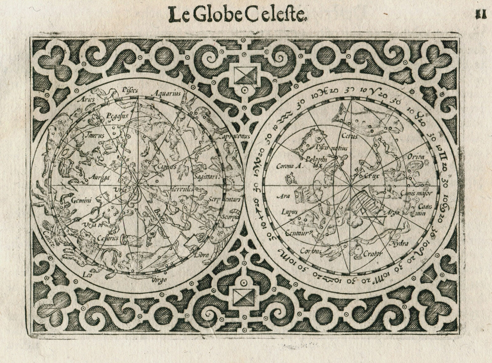
Original antique celestial map chart by Barent Langenes from 1609
$ 187.43
- Description
- Size Guide
Description
Free eBay listing template designed by dewiso.comLe Globe Celeste – Barent Langenes
Barent Langenes’ celestial map from a french edition of his Caert-Thresoor. The french edition was entitled “Thresor de Chartes, contenant les Tableaux de tous les Pays du Monde”. Based on the celestial map from Ortelius’ Epitome.
Title: Le Globe Celeste
Date: 1609
Size: 9.0 x 12.5 cm
Condition: Good (G)
Condition notes: Staining in upper left corner.
M. Rasmussen Antique Maps, Books & Prints
We are an online based antique map dealer with focus on maps from the 16th to the 18th century. We also feature antique books and prints. Our goal is to offer rare, decorative and interesting items, while providing excellent service and guidance.
Worldwide delivery (we ship within 2-5 business days)
Only original antique Maps, Books & Prints
Sign up to our newsletter for updates on new arrivals
M. Rasmussen Maps, Books & Prints (VAT DK38576593)
Ejbyvej 10, 4700 Næstved, Denmark
